The Atlantic Tour, Achill Island in Co. Mayo
THE START
Begin your journey at Achill Sound and take the R319 across the Michael Davitt Bridge. To the left of the road you will see the Railway Hostel which was once the end-of-line station for the Achill rail line. Continue through the village of Polranny and on into Tonragee. This area is all part of the Gaeltacht, or Irish-speaking area.
Driving along the road, you can see Blacksod Bay to the left and the mountains of the Currane Peninsula to the right. Quite a lot of the mountain area is forestry area of pine and other evergreen trees. There are also several paths and trails through the hills, most of which are marked on the Ordnance Survey Map No. 30.
Continue to follow the road until you arrive at the junction. Here the road branches off to North Mayo, going through Ballycroy and on into Belmullet, however our journey takes the sharp turn at Mulranny Church and back into the Curraun Peninsula.
CURRANE PENNINSULA
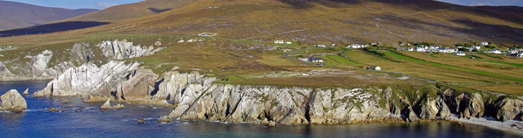
This coast road runs quiet close to the cliff edge providing spectacular views of Clew Bay with its 365 islands. The twisting road passes through the villages of Cushleka and Dooghbeg. Croagh Patrick can be seen across the Bay and Clare Island and Achill Beg Island are visible.
Follow the road into the village of Curraun, where a copper mine was once worked and where the founder of the British police, Sir Robert Peel, once resided. Curraun House, locally known as 'the George', was once the site of a famous tropical garden, and for many years was the house of the landlord Dickens. Taking the road through the village, you will drive for some miles along the coast of Achill sound. To your right is Curraun Mountain which is the site of several corries and small lakes.
Drive back into Achill Sound and continue across the bridge. At the end of the village take the left turn signposted the Atlantic Drive. This road, lined with rhododendrons in early summer takes you through the villages of Shraheens and Derreens. Continue on and pass the graveyard and Kildamhnait Castle on the left, and take the right hand turn when you reach the junction.
THE ATLANTIC DRIVE
You are now travelling along the spectacular 'Atlantic Drive', overlooking the ocean and the islands of Clare and Achill Beg. The road twists and snakes along the cliffs, deceptively close to the edge, allowing an unparalleled view of the Achill coastline. During the summer of 1997, a portion of this road was closed when an Australian/Irish film crew shot scenes for a Famine movie in this area.
Having followed the road as it rises steeply, you will come to the top of a hill which looks down into the village of Ashleam. Here, the road descends in a series of hairpin bends, overlooking the inlet of Ashleam Bay. Continue along the Atlantic Drive route until you reach the seaside village of Dooega, which boasts one of Achill's five Blue Flag Beaches.
MINAUN HEIGHTS
Taking the main road through Dooega, you will reach a left turn leading to Minaun Heights. This steep road ends at a hill-top viewing point, giving a breathtaking view of Achill Island. On a clear day, you can see the entire area and also Blacksod Bay and the Belmullet Peninsula. Back on the main road, stop off in Cashel for a while and then return to Achill Sound through the beautiful forested area of Glendarrary. This was once part of the estate of William Pike, a well-known Achill landlord.