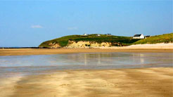
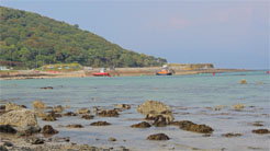
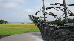
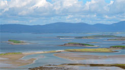
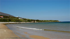
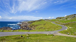
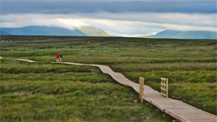
The Wild Atlantic Way in Co. Mayo

Wild, Rugged, Liberating ...

The Wild Atlantic Way is a 2500km (1500 miles) driving route, stretching from Malin Head in County Donegal to Kinsale in County Cork along Ireland’s western seabord. It was launched in February 2014 by Junior Tourism Minister Michael Ring and it traverses the entire rugged and spectacular west coast of Ireland from Cork through counties Kerry, Clare, Galway, Mayo, Sligo, Leitrim to Donegal.

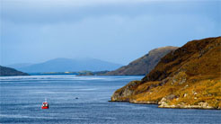
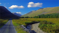
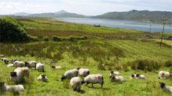
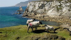
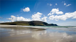
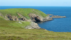
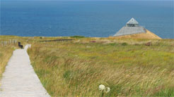
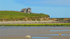
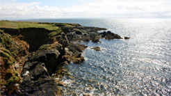
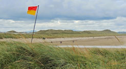
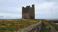
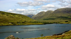
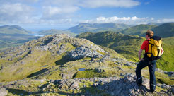
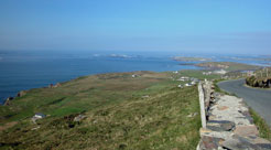
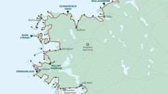
In Mayo the Wild Atlantic Way is a 543km coastal drive and much of Mayo’s spectacular natural scenery lies along it.

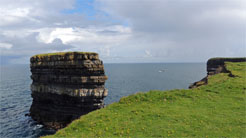
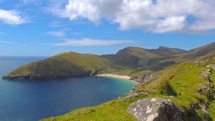
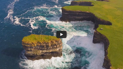
In Mayo there are thirty-one Discovery Points and two of them are indicated as Signature Points: Downpatrick Head and Keem Strand. Reading our mini-guide, you can travel the Mayo section of The Wild Atlantic Way or pick your part of the Atlantic coastline to explore.

Signature Points
Downpatrick Head
Downpatrick Head

Downpatrick Head is one of the Signature Point on the Wild Atlantic Way and commands breathing views on the Atlantic.

Keem Strand
Keem Strand

A magnificient rural and shelterd beach on the east on Achill Island.

Discovery Points
Killary Harbour
Killary Harbour

Killary Harbour, An Caoláire Rua in Irish, is the Ireland’s only fjord, which forms a natural border between counties Galway and Mayo.

Doo Lough Famine Memorial

Doo Lough Pass is a spectacular setting near Doo Lough between Mweelrea Mountain and Sheeffry Hills

Silver Strand
Silver Strand

Silver Strand is a remote and unspoiled beach located approximately 25km south of Louisburgh.

Carrowmore Strand
Carrowmore Strand

Carrowmore Strand is a machair beach set between a rocky outcrop in a small bay off Clew Bay.

Old Head
Old Head

Old Head beach, near Louisburgh, is overlooked by a woodland to the west and Croagh Patrick to the south.

Murrisk Viewpoint
Murrisk Viewpoint

Murrisk view point is located on the south shore of Clew Bay at the base of Croagh Patrick, adjacent to Murrisk Abbey.

Clew Bay
Clew Bay

Clew Bay (in Irish: Cuan Mó) is the most spectacular bay in Ireland.

Dooghbeg
Dooghbeg

This elevated discovery point offers open and panoramic views south and south east across Clew Bay.

Spanish Armada Viewpoint

The Spanish Armada view point offers exceptional views south across Clew Bay and south west to Clare Island.

Ashleam Bay
Ashleam Bay

Ashleam Bay offers one of the most breathtaking views on Achill Island.

Keel Beach
Keel Beach

Keel Beach is one of the most popular and magnificent sandy beaches on Achill Island.

Doogort
Doogort

Doogort Beach, sheltered by the magnificent Slievemore mountain, is also known as Golden Strand.

Dooega
Dooega

Dooega beach is a small coastal inlet located on the south western side of Achill Island.

Elly Bay
Elly Bay

Elly Bay is an area of great scenic beauty and tranquillity in North West Mayo.

Fallmore
Fallmore

Fallmore is a town-land near Belmullet with Blacksod Bay to the south and east, and the Atlantic.

Blacksod Harbour
Blacksod Harbour

Blacksod Harbour is a working harbour with an accompanying lighthouse, Blacksod Lighthouse.

Annagh Head
Annagh Head

Annagh Head, on Mullet Peninsula, is one of the most ancient site on the Wild Atlantic Way.

Erris Head
Erris Head

Erris Head is at the top of the Mullet Peninsula.

Benwee Head
Benwee Head

This Dicovering Point offers some of the most dramatic coastal scenery on the Wild Atlantic Way.

Ceide Fields
Ceide Fields

The Céide Fields, near Ballycastle, certainly gives you a unique experience.

Lacken Bay
Lacken Bay

Lacken and its bay nestle along the rugged North Mayo coastline, between the towns of Killala and Ballycastle.

Killala Quay
Killala Quay

Killala (in Irish: Cill Ala) is a picturesque seaside village six and a half miles north-west of Ballina.

Ballina Quay
Ballina Quay

Ballina Quay is the Mayo’s last Discovery Point on the Wild Atlantic Way.

Islands
Clare Island
Clare Island

Situated at the entrance to Clew Bay, Clare Island is the largest of the Mayo offshore islands.

Claggan Island
Claggan Island

Claggan is a tiny island off Achill. It is the newest Mayo’s island having only being declared an island in 1991.

Inishturk
Inishturk

Inishturk, meaning “Island of the Wild Boar”, is a quaint beautiful island located 14.5km off the coast of Mayo.

Inishbiggle
Inishbiggle

Inishbiggle or Inis Bigil is located between the mainland and Achill Island.

Inishkea
Inishkea

Iniskea islands are situated on the west coast of the Mullet Penisula and they are rich in amazing scenic and rare wild life.

Around Mayo
Enniscrone
Enniscrone

Enniscrone Beach stretches for 5km over a long area of shoreline between Cliff Road and the mouth of the River Moy.

Easkey
Easkey

Easkey Discovery Point offers wonderful views over the Atlantic and on to the Slieve League and Benbulbin mountains.

Killary Harbour South

Killary Harbour is one of the Signature Points of the Wild Atlantic Way South of Co. Mayo.

Connemara National Park

Nowadays Letterfrack village is better known for the Connemara National Park.

Crump Island View
Crump Island View

This Discovery Point is a lovely sandy beach located on the north coast of the Renvyle Peninsula.

The Sky Road
The Sky Road

The Sky Road Discovery Point in one of the most spectacular points on the Wild Atlantic Way south of Co. Mayo.

Derrigimlagh Bog
Derrigimlagh Bog

Derrigimlagh Bog is a spectacular blanket bog near Clifden.

Bunowen Bay
Bunowen Bay

Bunowen Bay boasts a lovely white sandy beach on the Slyne Head promontory.

More
Wild Atlantic Way Map
Ballycroy National Park
Blue Flag and Green Coast Beaches
Aerial View
Aerial View
Other Things You Might Like